
Features CityHikes Hiking Trails Vienna
The CityHikes app is intended to provide an overview of the city hiking trails in Vienna.
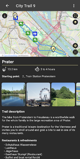
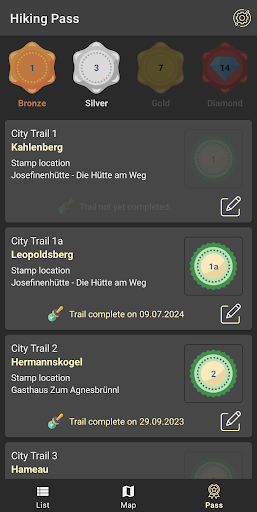
It is intended to be used both for planning a hike on a city hiking trail and for navigation during the hike.Various types of maps are available for easier navigation, including topological maps with altitude information and satellite maps.The app includes a digital hiking pass that lets you collect stamps for hiking the city hiking paths.
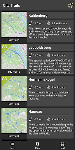
Collecting stamps will earn you hiking badges.There are a total of 14 hiking trails in and around Vienna:City hiking trail 1 - KahlenbergCity hiking trail 1a - LeopoldsbergCity hiking trail 2 - HermannskogelCity hiking trail 3 - HameauCity hiking trail 4 - Jubilee waiting roomCity hiking trail 4a - OttakringCity hiking trail 5 - BisambergCity hiking trail 6 - Zugberg-Maurer WaldCity hiking trail 7 - Laaer BergCity hiking trail 8 - SophienalpeCity hiking trail 9 - PraterCity hiking trail 10 - Franz-Karl-Effenberg hiking trail in DonaustadtCity hiking trail 11 - Urbaner GemeindebauCity hiking trail 12 - WienerbergThis app is a private, non-commercial project.
The app can be used free of charge and does not contain any ads – and nothing will ever change that.
Secure & Private
Your data is protected with industry-leading security protocols.
24/7 Support
Our dedicated support team is always ready to help you.
Personalization
Customize the app to match your preferences and workflow.
See the CityHikes Hiking Trails Vienna in Action
Get the App Today
Available for Android 8.0 and above